|
|
|
B7
|
Rif. Casoni Solarie » Rif. G. Pelizzo
|
|
This stage crosses the southern slope of M. Colovrat and then goes down into Topolò. Once through the Bocchetta di Topolò gap and past the woods and fields the trail follows the “strada di Rommel” (Rommel’s Road) to mount Matajur and the nearby Pelizzo Hut.
Detailed route description

The route takes the walker across the south face of Mt. Colovrat, just below the crest of the ridge. This is where the Battle of Caporetto took place in the autumn of 1917. Follow trail 746, first to the Zanuso bivouac (1065m), then to the hamlet of Lase (756m), and then down to Topolò (531m). Trail 745 then leads over the Bocchetta di Topolò pass to the village of Polava, and then to Cepletischis (547m). From here trail 736 heads through thin woodland and fields, past ruins of military fortifications and along the track known as “Strada di Rommel” (Rommel’s Way). It heads up Mount Matajur (1641m), from the top of which a 20 minute walk leads down to the G. Pelizzo hut (1320m). The views here are stunning. To the north are the highest peaks of the Giulian Alps and the Caporetto plain below, with the Isonzo river running through it. To the south are the plains of Friuli and, to the west, the Carnia Alps and the Dolomites around Belluno.
(Regione Friuli Venezia Giulia)
Natural and cultural heritage
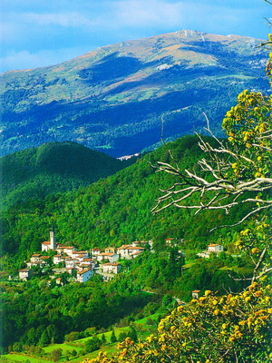
The Via Alpina trail goes through some charming villages, perched on ridges that descend from the Mount Matajur range, divided by deep gullies down which torrential streams rush. All of the surrounding area (the Natisone valleys) contains many examples of a creditable local architecture, an expression of the local culture which, though not rich, has endured the test of time. The pastures, now abandoned, are an amazing setting for walks, particularly after the first snow. The mountains here are bare but nevertheless capable of arousing interest and passion. Bears still live in the area. Local culinary traditions have been kept alive, albeit sensitively updated. Every year at midnight on New Years Eve, tradition dictates that everyone meet at the top of Mount Matajur to exchange New Year wishes, regardless of the freezing temperatures and the snow. In nearby Slovenia is Kobarid/Caporetto. This small town lies on the ancient river bed of the Soča/Isonzo river, 9 kilometres from the border with Italy. Today it is an interesting place to visit and is home to a museum that illustrates the events of World War I. It was inaugurated in 1990 and declared a European Museum in 1993, and it illustrates the military operation conducted at the Isonzo front in October 1917. A trail leads from the main square to the Italian Ossuary, and then on the Tonovcov Grad pass and what remains of the Italian defences. The museum also houses many artefacts that date from the Mesolithic period to the late middle ages.
(Regione Friuli Venezia Giulia)
Useful topographic maps
-
041 ~ TABACCO (1:25000)
-
L'alta via delle Valli del Natisone ~ Club Alpino Italiano - Sezione di Cividale del Friuli (1:50000)
Picture gallery


Last update : 2009-12-03

 |
5h20 |
16.5 km
|
658 m
|
325 m
|
5h20 |
16.5 km
|
658 m
|
325 m


Favourites, criticisms ? Make your personal comments on this stage. For more general notes please use the comments section of the page Over to the Via Alpinists.