Hiking (mountain trail, in places narrow and exposed)
Alpine route (equipped or very exposed section, snow field, blocks)
A32
Bad Goisern » Gosau
|
6h25 |
13.7 km
|
1074 m
|
810 m
This stage offers just what it promises: after the ascent to the Goiserer hut, you can stand here for a wonderful view of the Tote Gebirge and Dachstein mountains and the Trauntal valley. An even more impressive view can be enjoyed from only 1h away on the Hochkalmberg (1,833m), a highly recommended climb.
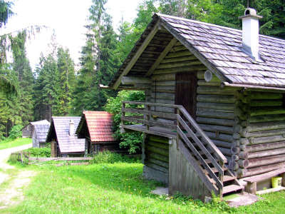
In Bad Goisern, keep heading towards the railroad crossing on passing the parish church, cross it and the river Traun and keep to the right following the asphalt road uphill. Unfortunately, you will have to travel the first stretch of the way along the Ramsaubach stream on the asphalt road until the car park, which is a starting point for day trips to the Goiserer Hut. Here, now follow the forest road uphill to the right. After approx. 1h 30min, you will reach the Trockentannalm meadow from where a track leads into the wood. It starts off as a relatively easy track, but soon becomes very steep and the term "Saurücken" (sow’s back) takes on a whole new dimension. Even half way there, the view back over the Sandling, the Loser and the Tote Gebirge mountain range is marvellous. You will once again arrive on the roadway. Keep to the right here and you will immediately see the onward course of the track again. Cross the bed of the stream and wind your way further steeply uphill. The wood progressively thins out, with more larches joining the woodland company of the mountainous region, and the temperature continues to rise. That is why you will now really be longing for the Dichteringquelle spring. The fresh spring water is ice-cold and crystal clear (approx. 1h 30min from the Trockentannalm meadow). After a short rest in the shade, you can tackle the last stretch of the climb feeling refreshed. The view over the Hoch Kalmberg peak is wonderful, the track is no longer so steep and the pines and alpine grass have made room for the larch trees. After another 30min, the Goiserer Hut in its extraordinarily beautiful setting is reached and offers a tremendous view from its lofty hilltop. Apart from this, the service at the little refuge is excellent, with roast pork and various homemade cakes and tarts no uncommon occurrence. From the refuge, follow the signposting to the Iglmoosalm meadow. The trail leads at a leisurely pace downhill to the nice little Schartenalm meadow, whose very particular charm is conjured up by the numerous stone walls. Walk further down through the wood and you will reach a newly laid roadway, which runs on the already existing one. Follow this further down to where the Gosaukamm ridge can already be seen emerging from between the trees. Finally, a track branches off to the left through the wood to the Iglmoosalm meadow (approx. 70min from the Goiserer Hut). After a short while on the roadway – keep to the left at the fork in the road – the trail again continues steeply downwards through the wood. Cross the roadway once before reaching a football pitch just above Gosau. Here, keep to the right and follow the "Panoramaweg Kalvarienberg" signposting. The path leads along the sloping ridge in lovely surroundings somewhat above the valley until reaching the main road. Cross the road and keep following the signposting, reaching the Kalvarienberg mountain. Go down the stone steps and you will arrive directly at the church and the Kirchenwirt inn (approx. 1h 20min from the Iglmoosalm meadow). Walk over the Kalvarienberg and along the panoramic track to reach a little football pitch above Gosau. Keep to the left here and head uphill through the wood. The trail to the Iglmoosalm meadow and the Goiserer Hut is well marked. (Christina Schwann, OeAV)
Natural and cultural heritage
Only a short distance from the Goiserer Hut, the trail branches off to the Kalmberg peak. From a certain point, its profile looks like the head of an Indian. A little below the summit track, a narrow path branches off to a cave by the name of Kalmooskirche. In the 16th century, the followers of Martin Luther – mainly wood workers and miners, who were particularly open to the teaching of the miner’s son – met here for secret services. At the time, almost all of the inhabitants of Gosau were already Protestants. They opposed the Counterreformation for 157 years by keeping their convictions and passing them on. In 1731, Archbishop Firmian of Salzburg had over 30,000 Protestants driven from their homes, and they were also joined by many from Gosau. Even the Empress Maria Theresia had stubborn "heretics" deported to Hungary and Siebenbürgen and forced mothers to bring their children up in the Catholic tradition. It was only when Emperor Joseph II enacted the so-called diktat that the time of persecution came to an end. Only 11 of a total of 173 houses in Gosau remained Catholic and even today, nine tenths of the population are Protestant. The descent from the Goiserer Hut soon brings you to the lovely Schartenalm meadow, where the many stone walls are the most distinctive feature. These were built in about 1864 when servitude rights were being established in the course of the propertyredistribution. The stone walls separate the huts and the surrounding green, which belongs to the farmers, from the servitude meadowland of the federal forests. Like Bad Goisern, Gosau is rated as a UNESCO "World Culture and Nature Heritage” site. The Gosausee lake is especially picturesque. This little mountain lake under nature protection stands out due to the clarity and drinking water quality of its water. It provides a habitat for numerous aquatic animal species. The world traveller and naturalist Baron Alexander von Humboldt called the lake, which forms the very end of the valley before the mightily towering peaks of the Salzkammergut, the "Eye of God". But the cultural landscape of the Gosautal valley is also interesting: a special farmstead type was developed at the turn of the 16th to 17th century: the “Paarhof” (two parallel two-storey houses). This construction method can be seen in the Paarhof Gosau-Hinterthal open-air museum, where it is also possible to gain an overview of the farming lifestyle then. (Christina Schwann, OeAV)
Other long-distance trails and alternative routes
Walk from the Goiserer Hut to the Hochkalmberg mountain, from which the impressive "Indianerkopf" (Indian head) can be seen (only 15m below the summit cross). Higher altitude alternative: Bad Goisern - Hallstatt - Wiesberghaus lodge - Simony-Hut (7-8h); north alpine trail 01
Favourites, criticisms ? Make your personal comments on this stage. For more general notes please use the comments section of the page Over to the Via Alpinists.
Von solchen Abkürzungen halte ich nichts, entweder ich gehe die Via Alpina Ober ich mache eine Busreise. Die Goisererhütte kann ich nur empfehlen. Extrem gutes Essen und sehr nette und freundliche Leute.
Automatic translation
[Google]
I do not think anything of such shortcuts, either I go down the Via Alpina I make a bus trip. I can only recommend the Goisererhütte. Extremely good food and very nice and friendly people.
bergziege - 2012-09-10
Wenn man abkürzen von Bad Goisern mit dem Bus nach Gosausee und dort mit der Seilbahn weiter
Automatic translation
[Google]
If you abbreviate of Bad Goisern Gosau by bus to the cable car and there continues

 |
6h25 |
13.7 km
|
1074 m
|
810 m
|
6h25 |
13.7 km
|
1074 m
|
810 m


Favourites, criticisms ? Make your personal comments on this stage. For more general notes please use the comments section of the page Over to the Via Alpinists.