Hiking (mountain trail, in places narrow and exposed)
Alpine route (equipped or very exposed section, snow field, blocks)
R7
Idrija » Planinska koča na Ermanovcu
|
7h00 |
25 km
|
1278 m
|
664 m
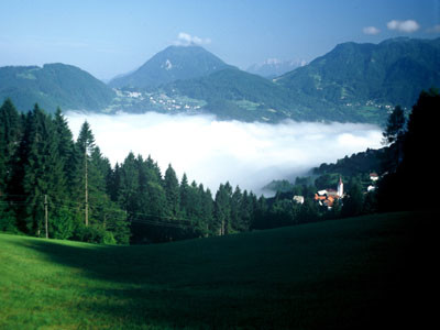
This stage runs over the Idrija and Cerklje hills. The initial steep climb through the forest is followed by a casual hike over mountainous terrain. There are many forests and meadows, farms, churches and settlements. The churches in particular will not go unnoticed. Most of the route follows a tarmac road overlooking the Idrijca valley, and a certain amount of caution is advised.
From the bus station in Idrija, follow the road to the right eastwards across the Idrijca river, then up Župančičeva ulica street. Follow the stone footpath into the beech wood, then climb up the steep slope to a point overlooking the valley. Continue along the dirt track at the top walking eastwards. At the edge of the forest, leave the dirt track and climb up the meadow to the road that runs to the hamlet of Gore. 1h 25 min. Turn left onto the tarmac road and go round the southern slopes of Cajni vrh. On the other side, climb down to the hamlet of Ledinsko Razpotje to reach the regional road leading to Spodnja Idrija. Follow the road for 100 m to the junction, then turn left onto the road leading to the village of Pečnik. At the next junction, turn right off the road then cross the meadow to the village of Ledine. 1h 30 min. Go through the village, passing the church to the local road, which leads to the Partisan cemetery. Follow the road that climbs up the wooded western slopes of Trepalova Sivka. A junction lies at the top of the pass. 30 minutes. Continue along walking the road and descend from the junction where a road turns right towards the village of Žiri. Continue walking along the local Sovodenj road for about 5 minutes, then turn left onto the path crossing the meadow. After 10 minutes you arrive at a forest path next to a farmstead. Walk along the forest path for about 10 minutes, then turn right towards the Likar farmstead, where the forest path ends. Climb up the dirt track that branches off the forest path and up the steep slope of the meadow to the farmstead. Follow the road, go onto the dirt track above the road and descend to the holiday homes estate. From here, turn right and follow the forest path to the tarmac road near the Lanišar farmstead. 45 minutes. The road turns right and climbs up to the pass, where there is a road-side chapel. Turn onto the poor road on the right, and climb up to the forest road which leads to the Pleč farmstead and the dirt track. Follow the path across the meadow to the dirt track, which leads almost to the summit of Bevkov vrh (1,051 m). Cross the forest path and pass the large Bevk farmstead to the chapel next to the path. 1h 15 min. From the chapel, cross the meadow then descend down a steep slope through the wood. After reaching the dirt track, turn left and climb down another steep slope. This brings you to a meadow and a road running left to the junction on the Veharše pass. Follow the path northwards through the wood, cross a hillock then descend the meadow on the other side to the junction on the pass. The dirt track leads to a plateau, then passes a farmstead and goes through a wood before descending to the tarmac road on Kladje (787 m). 1h. Cross the main road and climb up the side road. A 30 minute walk leads to a junction where one road turns left towards Dolenji Novaki, which is also traversed by the Via Alpina. Our route takes us to Planinska koča na Ermanovcu (968 m). To get there, continue along the ridge up to the Laniščar farmstead, then turn left into the hill and follow the path through the wood. Go round the Panc peak (1,048 m) then descend to the road and follow it to the destination. 30 minutes. The hike takes 7h 50 minutes to complete.
Source: Dobnik, Jože; (1998). Slovenska planinska pot. Planinski vodnik. Ljubljana Založba PZS. Atlas Slovenije. (1996). 3. izpopolnjena in razširjena izdaja. Ljubljana: Mladinska knjiga in Geodetski zavod Slovenije (GZS). Škofjeloško in Cerkljansko hribovje. (1993). Izletniška karta. 1:50.000. Ljubljana: GZS. (Peter Šilak)
Natural and cultural heritage
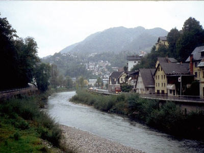
Idrija lies in a basin in the middle of a hilly, forested and well-watered region. It is known for the second-biggest mercury mine in the world, immediately after Almadena in Spain. One evening in 1490, a native of Idrija, then an unknown village, dipped his pail into a pond of water, the next morning, he was unable to lift the pail, which was filled with a heavy, glistening liquid - native mercury had collected at the bottom of the pail. The news spread quickly and a mine was built within a few years. The mine remained in continuous operation for 500 years, until the end of the 20th century. It was 15 storeys deep and its ore produced over one hundred thousand tons of mercury over the centuries. Today, the miners are gone and have been replaced by tourists visiting Antonijev rov, the oldest tunnel in the mine, which has been converted into a museum. The development of the mine was closely affiliated with the development of technology. Many inventions can be seen in the town and its surroundings. In the wild valley of the Idrija hills, huge barriers were built to collect water so that logged timber could be floated to Idrija. In Idrija, wooden barriers stopped the timber, which the mine used in huge quantities. Water was pumped out of the mine by the Kamšt, a pump with a large wooden wheel, which survives to the present day and is the biggest of its kind in Europe, and to which the waters of the Idrijca flowed through a series of troughs. The Frančiška shaft, opened in the late 18th century, has also been converted into a museum of old mining equipment. A typical miner's house has been renovated and is also on display. Grad, the former mine administration building and mercury warehouse, is today a richly furnished museum where we can find out about the history of mining and Idrija. There is also a strong emphasis on another one of Idrija's characteristics - lace. Delicate white lace stands in sharp contrast to the dark, rugged and perilous depths that fashioned the fate of the town and its townsfolk. Idrija is surrounded from all sides by steep ridges and tall mountains. Our route takes us to the western end of the Idrijca valley, across a steep slope to a high ridge on the Gore mountains. Only a few peaks on the ridge are taller than one thousand metres (Sivka, Bevkov vrh). The ridge broadens at a number of places, creating small plateaux (e.g. Ledinska planota). Small settlements and individual farmsteads are scattered across the slopes and below the peaks. The Slabe farmstead near Bevkov vrh, like so many others, has been abandoned for life in the valley below. But there are many others, such as the farmstead at Na ravni, also near Bevkov vrh, where a combination of home-made, environmentally-friendly products and tourism has enabled survival, and where the shrieks of playing children may still be heard. Sources: http://www.muzej-idrija-cerkno.si/ (Mestni muzej Idrija) http://www.rzs-idrija.si/ (Idrija) (Igor Maher)
Useful topographic maps
Škofjeloško in Cerkljansko hribovje ~ Geodetski zavod Slovenije (1 : 50 000)
Useful guidebooks
Slovenska planinska pot ~ Planinska zveza Slovenije (ISBN 961-6156-11-x)
Vodnik po planinskih postojankah v Sloveniji ~ Planinska zveza Slovenije (ISBN 961-6156-10-1)
Picture gallery
Add your own pictures!
Comments
Favourites, criticisms ? Make your personal comments on this stage. For more general notes please use the comments section of the page Over to the Via Alpinists.
Rembert Biemond - 2024-03-31
We did this stage as the previous on out of season, on March 25, 2024.
It is a stage which can be done very well out of season. The initial text on this page is adequate. It starts with a steep climb and then thereafter it is easy, but long. On the Komoot app there is some confusion about the way out of Idrija. Follow the donots as commented earlier (red ring with white in the middle). It is a 25 km stage so it will keep you busy for a while. We actually did some 85% of the route and then diverted to "Forest Paradise" (Google or booking) a B & B. Can be recommended highly. It is just 500 m from the route. We got a fantastic local dish and a great breakfast. Why didn't we go to the Mountain Hut Planinska koča na Ermanovc? Winterclosed! and no Winter Room.
M&M - 2023-09-10
Der etwas längere Weg zur Planinska koca na Ermanovcu hat sich für uns auf jeden Fall als gute Wahl erwiesen. Sehr freundlicher Hüttenwirt! Wir waren den ganzen Tag im Regen unterwegs und er hat extra für uns den Kachelofen eingeheizt und wir hatten am nächsten Tag tatsächlich wieder trockene Schuhe.
flautix - 2023-08-20
Danke für die Hinweise zur geänderten Wegführung und der Übernachtungsmöglichkeit in Na Lanisah bei Damjian auf dem Baurnhof. Ich habe beides hier in den Track integriert:
https://www.komoot.de/tour/1270649633?ref=wtd&share_token=aS6zOegdFgHfTCUbzG6D9BWFUgjDPNQpdVHDDpM41dt1dZK48n
Neben dem Hochzeitsstadel gibt es über der Gemeinschaftsküche nun sechs schöne Schlafplätze mit Matratzen und Bettwäsche. Man muss also kein Zelt dabeihaben. Wir hatten länger im Voraus per Mail reserviert und Damjans Frau hat uns eine ganze Auswahl an Lebensmitteln für Abendessen und Frühstück in den Kühlschrank gestellt, so dass wir uns bestens selbst versorgen konnten. Übernachtung kostet so 20.- € pro Person plus Kosten für die verbrauchten Lebensmittel. Wir fanden es supernett dort!
Stephanie - 2023-05-31
When leaving Idrija, cross the bridge and follow the signs and GPS for route ‘1’ (slovenska planinska pot). Do not follow the GPS for the Via Alpina. When following the ‘1’ you will quickly come across a Via Alpina sign (see photo above). From Ledinsko Razpotje the GPS is correct again.
Ingo - 2022-09-17
We followed the comments of Maria, Ludovic and Karsten (below) and went straight to Damians place. We can 100% confirm what they wrote: Damian is a great guy! We simply showed up without calling or writing before, were allowed to camp at his place and had our first real shower in days. He also sold us some food so we didn´t have to go to Cerkno. It was the last chance to buy food in days. There is no shop in Dolenji Novaki (R8)!!!
Bernd - 2022-09-01
Wir fanden den Doppelweg zur "na Ermanovzu" (Anmeldung am besten auf Englisch via SMS an die angegebenen Nummer) als lohnend: sehr nette Wirte, große Essensportionen zu verhältnismäßig niedrigen Preisen und am nächsten Morgen konnte man erholt die nahen Infos zu den Rapallo-Vereinbarungen aufnehmen.
Bernd - 2022-09-01
Die Wegführung wurde geändert: Es geht nicht mehr zum Marutnik hoch, sondern bald an einer Wegverzweigung mit Infoschild nach links auf einem schönen Waldweg - deutlich weniger anstrengend und in diesem Bereich keine Gefahr, den falschen Weg zu nehmen!
Allerdings an 2 anderen Stellen verstellbare Weidezäune, so dass man ein wenig improvisieren musste (gut auf die Wegmarken achten!)
Julien - 2022-08-05
Decided to resupply at Cerkno as it seems a better option than pod brdo. 2 supermarkets but no camping. Spar has much more choice than mercator. Ended up sleeping in a kindergarten next to the volleyball playground. Nice and quiet with water.
Oliver - 2022-07-06
The climb out of Idrija is quite steep and partly overgrown with stinging nettles. consider long pants. In ledinsko is a small guesthouse that can be used for first or second breakfasts ;)
Karsten - 2022-07-04
I can absolutely confirm the experience of Maria and Ludovic below: The friendly staff of Hostel Idrija had called "Kmetija na Lanisah" and Damian welcomed me at the wedding location some meters after his farm. I was allowed to use the facilities and even sleep in the kitchen due to escape the rain. He even had a beer or me, just bring your own food! When his cows escaped from the paddock later that evening I alarmed hin and chased them back, thus being able to compensate his hospitality a bit ;)
Lovely place (for weddings as well as for tired hikers) and very charming people! Highly recommended to visit them!
Ludovic - 2022-06-25
Following Maria's comment (just below) I phoned the owner of the house who I also found on Google Maps (he has a website). And despite the fact that I wanted to sleep there on a Saturday night when a wedding party was going to take place, he kindly offered to come anyway. Arrived when he was in the middle of a rush for the organization of the wedding, he welcomed me with great kindness and arranged for me to take a shower and show me a pleasant and quiet place to put my tent. The place is beautiful and peaceful and I highly recommend as well as Maria!
Maria - 2022-05-08
This stage ends at the mountain hut Ermanovcu. We thought it is a pity that the last 2,2km (the end of the stage) is the same as the first 2,2 km of stage R8 (the next day). So we asked the owner of the house right at the junction of the stages (2,2 km before the end of stage 7) if it is possible to camp there. He tells us that he wants to start a campsite and shows us the garden where we can stay, the toilets, the hot shower and the cabin with a kitchen. He also has some mattresses in a cabin. It’s also a wedding location and the view is stunning. Highly recommended! Podlanišče 15, 5282 Cerkno 031 403 762 Mojca info@nalanisah.com www.nalanisah.com
Carsten - 2022-01-10
From Idrija to Guest House Kmecki Hram do NOT follow GPS coordinates and official trail description on via-alpina.org (they are WRONG -> no trail). Comments on Maps.Me seem to also direct one to this WRONG route. (AllTrails also uses these wrong GPS data.) Correct: In Idrija, after crossing the bridge and entering the road out of town (as the GPS data indicate), CONTINUE to follow paint marks (red doughnut with white in middle) and hope for the best (you are walking the updated, correct trail but without GPS waymarks). In R7, if one ever finds oneself on an enjoyable, level trail, it’s time to check one’s coordinates. One is almost certainly going in the wrong direction. The guidebook’s altitude gain of 1278m is an underestimate.
Water: pipe out of concrete encasement about half-way through R7 (trickle), and similarly about 85% through (good flow): 46°4’2170N, 14°1’6100E; 46°5’8310N, 14°0’1500E.
Edgard belgian hiker - 2021-11-09
Un grand bravo à l'auberge Robert Fortuna à Idrsek qui a ouvert ce lundi 08/11/2021 et m'a préparé un bon repas le soir alors que j'étais le seul client. Le petit déjeuner était gargantuesque. Je valide à 100%.
Gian franco Basso - 2019-06-17
dormi a Ermanovcu ou je suis passé en2016 la qualité de la prestation a beaucoup régréssé, propreté douteuse ,repas cher et frugal je ne recommande pas
Automatic translation
[Google]
I stayed in Ermanovcu where I stayed in 2016. The quality of the service was a lot under control, dubious cleanliness, expensive meal and frugal I do not recommend
POPEYE GG - 2018-06-12
13 juin 2017
Là encore, partant déjà de Irdrsek (donc en cours de l'étape R7), je suis allé jusqu'à Dolenji Novaki, au début de l'étape R8: en effet, l'hébergement de fin d'étape R7, Planinska Koca na Ermanovcu n'est ouvert qu'en fin de semaine ou alors il faut téléphoner (pas facile comme d'habitude à cause de la langue), et en plus on évite un aller et retour.
Ai passé la nuit à l'hôtel Gacnik aux coordonnées N46°08,733 E14°01,568 (il faut prendre à droite sur la route en sortant du chemin, pas de fléchage!).
Automatic translation
[Google]
June 13, 2017 Again, leaving already from Irdrsek (so in the course of stage R7), I went to Dolenji Novaki, at the beginning of stage R8: indeed, the end-stage accommodation R7 Planinska Koca na Ermanovcu is only open at the end of the week or you have to call (not easy as usual because of the language), and you can not go back and forth. Stayed overnight at the hotel Gacnik at the coordinates N46 ° 08,733 E14 ° 01,568 (you have to turn right on the road out of the way, no signs!).
Nice people at the restaurant though. Hiking from Idršek to Idrija was kind of a search, there was a sign that leads you into the forest, but the path is blocked with fallen trees and totally overgrown after that. I had fight my way through the forest to get back to the road (which is actually the GPS track).
The youth hostel in Idrija is a nice and cheap place to stay (€11,08 pppn). I was alone in the dorm :-).
Maybe I misunderstood the symbols, but also in Idršek is no grocery store or what so ever.
knfkwnfvw - 2017-08-31
test
Klaus - 2016-09-16
Ermanovcu dom ist die erste Berhütte auf dieser Tour: kleine Schlafräume mit (warmer) Gemeinschaftsdusche und atemberaubendem Ausblick von der Terrasse.
Leider spricht weder der nette Padrone, noch seine 5 anwesenden Landsleute irgendeine Fremdsprache. Aber für Gulasch mit Polenta, einem Tomatensalat und 3 Bier reicht es. Incl. ÜN/F kostet alles 27€!
Automatic translation
[Google]
Ermanovcu dom is the first Berhütte on this tour: small bedrooms with (warm) communal shower and stunning views from the terrace. Unfortunately, neither the nice Padrone nor his 5 compatriots present speak any foreign language. But enough for goulash with polenta, a tomato salad and 3 beers. Incl. Overnight / F costs 27 €!
Klaus - 2016-09-16
Tour 14.09.2016 - 9h
- 1:45 Aufstieg senkrecht im Wald ohne Serpentinen und mangelhafter Markierung.
- 1h Schotterweg bis zur 3-Sterne Pension Fortuna, die aber erst um 12:00 öffnet.
- 4:15 mit guter Wegeführung aber wiederum schlechter Markierung bis zum Bevkov Vrh.
- 2h auf größtenteils Asphalt-/Schotterstraße stetig bergan bis zur Ermanovcu koča (dom).
Automatic translation
[Google]
Tour 14.09.2016 - 9h - 1:45 ascent in the forest without serpentines and poor marking. - 1h gravel road to the 3-star Pension Fortuna, but only opens at 12:00. - 4:15 with good routing but again bad mark up to the Bevkov Vrh. - 2h on mostly asphalt / gravel road steadily uphill to the Ermanovcu koča (dom).
Elisabeth - 2012-11-30
Le début de l'étape est très mal expliqué. Encore un refuge fermé en semaine ! C'est le 3e...Heureusement, je randonne en autonomie complète. A noter qu'il est alors inutile de faire l'AR depuis la ferme Laniscar : la suite de l'itinéraire se prend en dessous de la ferme. L'étape dure au moins 8h.
Automatic translation
[Google]
The early stage is very poorly explained. Another refuge closed week! This is the third ... Fortunately, I hike in complete autonomy. Note that it is unnecessary to do so since the AR Laniscar farm: After the route is below the farm. The stage lasts at least 8 hours.
Check in the Idrija Tourist Office the availability of the Refuge of Ermanovca! They will phone to announce you are coming. The place is not frequented much, and closed on Mondays and Tuesdays.
Alpinisten - 2011-09-26
Achtung!Wenn man auf dem mit einer 1 markierten Weg aufsteigt, dann nicht fälschlicherweise oben nach rechts Richtung Gore dem Wanderzeichen folgen, sondern auf dem Makadamweg Ausschau halten nach einem weiteren Zeichen, das den richtigen Weiterweg geradeaus oder nach links markiert. Wir hatten das übersehen und liefen daher 2 Stunden unbemerkt in die falsche (südliche) Richtung. Der Weg war so schön, daß wir unsren Fehler erst in Urbanovc bemerkten...zum Glück konnte uns dann eine Bäuerin weiterhelfen, indem sie uns ein Stück zurück fuhr, sonst wären wir wieder in Idrija gelandet.
Automatic translation
[Google]
Please note: If you climb to the marked with a 1 way, then erroneously top right towards Gore follow the marked trail, but keep on the lookout for macadam another sign that the straight right or far way mark to the left. We had missed the 2 hours and therefore ran unnoticed in the wrong (south) direction. The road was so beautiful that we noticed unsren error until Urbanovc ... luckily we could then help a farmer by giving us a piece recoiled, otherwise we would have landed in Idrija.
Alpinisten - 2011-09-08
Wegen eines Gewitters mußten wir unsere Route leicht abändern und liefen anstelle zur Planinska koca na Ermanovcu nach Cerkno. Im "Hotel Cerkno" kann man wunderbar die regionale Küche genießen und sich im benachbarten Schwimmbad etwas erholen, wenn man sich einen Tag Pause im Hotel gönnen möchte. Man steigt ab hier 4h30 zum Porozen-Gipfel auf. In Cerkno ist die Wegmarkierung etwas versteckt.
Automatic translation
[Google]
Because of a storm we had change our route slightly and ran instead for Planinska koca na Ermanovcu to Cerkno. In "Hotel Cerkno" you can relax and enjoy the local cuisine and relax in the neighboring pool a bit if you want to treat yourself to a day of rest at the hotel. You climb from here on the 4:30 Porozen summit. Cerkno the path marker is somewhat hidden.
Apartma Rožica lies in the city centre of town Idrija and offers affordable accomodation with breakfast in rooms with air-conditioning, mini-bar, 24/7 Wifi high-speed Internet access and cooking facilities. The Family informs you about local sights, dishes and possibilities. Warmly recommended to all long-distance hikers going across Via Alpina!
robert - 2011-07-11
Mardi 14 juin 2011, le refuge était fermé; il y avait cependant une cabane en construction qui permettait un bivouac confortable et abrité de la pluie .Aller chercher de l'eau auprès des fermes en contrebas du refuge (500m)
Automatic translation
[Google]
Tuesday, June 14, 2011, the shelter was closed, however, there was a hut under construction which allowed a comfortable bivouac and sheltered from the rain. Fetching water from farms below the refuge (500m)
gonzom - 2010-08-10
Someone confuse "left"and "right" , "up" and "down" in the description of this stage!

 |
7h00 |
25 km
|
1278 m
|
664 m
|
7h00 |
25 km
|
1278 m
|
664 m


Favourites, criticisms ? Make your personal comments on this stage. For more general notes please use the comments section of the page Over to the Via Alpinists.