Create your own guidebook
Download track
Quality : very good
GPX KML CSV
Location
Italy
PIEMONTE
TO
Ceresole Reale - Groscavallo
Gran Paradiso
P.N.Gran Paradiso
Key to symbols   
Stage point (start or end of stage)
Intermediate accommodation possibility
Summit
Pass
Town, village
Other locality

Catering
Doctor
Chemist
Bakery / grocery
Hardware / sports shop
Post
Bank / cash dispenser
Train
Coach
Taxi
Open automobile access

A Tarred or paved road
B Dirt track
C Mule trail
D Mountain trail
E Equipped trail (cables, ladders)
F No trail

Stroll / tourism (broad, non-exposed trail)
Hiking (mountain trail, in places narrow and exposed)
Alpine route (equipped or very exposed section, snow field, blocks)
D29 Ceresole Reale » Pialpetta
  |   6h05   |   13.5 km   |   1172 m   |   1612 m

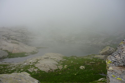
The Crocetta pass in the Locana valley, in the region of Canavese, leads to the Grande valley, one of the Lanzo valleys. A long climb from Ceresole Reale, followed by a long descent to Pialpetta on the Stura river in Valgrande, marks this typical connection stage between two valleys.

Point Segment
Name Services Information Marking
Ceresole Reale
1512 m
| D  7 km / 3h20
Colle della Crocetta
2622 m
| A  6.5 km / 2h45
Pialpetta
1070 m
Detailed route description
Other long-distance trails and alternative routes
Mostly follows the route of the GTA trail.
Useful topographic maps
  • 3 ~ IGC Il Parco Naturale del Gran Paradiso (1: 50000)
Useful guidebooks
  • CamminaitaliA, Carnovalini, Cannobini, Valsesia ~ CAI.TCI (ISBN 1995)
Comments

Favourites, criticisms ? Make your personal comments on this stage. For more general notes please use the comments section of the page Over to the Via Alpinists.


max. 1000 characters
  • FX - 2023-10-14
    Selon descriptif www.via-alpina.org. Itinéraire réalisé de Riale (D1) à MontCenis (D34) du 19/08 au 12/09/23.
    Tout le monde vous le dira "la Crocetta... ça grimpe !", normal vous allez passer de 1500 à 2600m d'altitude.
    Au départ, passer au dessus du refuge puis monter au ras de la digue, ce qui donne un bel aperçu de la retenue d'eau. Suivre dans un premier temps la route puis c'est partie pour une très belle montée d'abord dans les bois, puis prairies puis de plus en plus minéral jusqu'à Crocetta en suivant un balisage très bien fait. Quelques zones pourraient servir de bivouac, mais vous êtes toujours dans le Parc Gran Paradiso (et nous avons croisé un garde).
    La descente jusqu'à Pialpetta est interminable et rude pour les genoux (1 épicerie, 1 resto chic, 1 Posto Tappa).
    Trace GPX : https://www.openrunner.com/route-details/17072258
  • JeanCat - 2022-11-02
    Joli camping à Ceresole Reale.
  • tarjako - 2013-07-21
    A bit tricky 2 weeks ago due to snow. More tricky was finding the track on the other side. Further down no problem on finding the track.
  • fabio - 2009-08-13
    in discesa su Pialpetta sentero completamente invaso da vegetazione, spesso non evidente
    Automatic translation [Google]
    downhill on Pialpetta sentero completely invaded by vegetation, often not obvious
Last update : 2013-07-17