Create your own guidebook
Download track
Quality : rough
GPX KML CSV
Location
Italy
PIEMONTE
TO
RONCO CANAVESE
VALLE ORCO E SOANA
P.N.GRAN PARADISO
Key to symbols   
Stage point (start or end of stage)
Intermediate accommodation possibility
Summit
Pass
Town, village
Other locality

Catering
Doctor
Chemist
Bakery / grocery
Hardware / sports shop
Post
Bank / cash dispenser
Train
Coach
Taxi
Open automobile access

A Tarred or paved road
B Dirt track
C Mule trail
D Mountain trail
E Equipped trail (cables, ladders)
F No trail

Stroll / tourism (broad, non-exposed trail)
Hiking (mountain trail, in places narrow and exposed)
Alpine route (equipped or very exposed section, snow field, blocks)
D26 Talosio » San Lorenzo
6h00   |   15.68 km   |   1696 m   |   1874 m

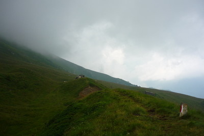
The first part of the stage along the bottom of the valley follows a road. A broad trail then crosses high pastures up to the Crest pass. Through steep grassy slopes the trail goes down to the Shrine at Prascondù, near the hamlet of Talosio, which can be reached by road.

Point Segment
Name Services Information Marking
Talosio
1223 m
| D  4.88 km / 2h10
Bivacco Blessent Redentore
1938 m
| D  3.67 km / 0h50
Lago d'Eugio
1891 m
| D  3.38 km / 1h05
Alpe Praghetta
2143 m
| A  3.75 km / 1h55
San Lorenzo
1041 m
Detailed route description
Natural and cultural heritage
Other long-distance trails and alternative routes
The trail mostly follows the route of GTA stage 230.
Useful topographic maps
  • 3 ~ IGC Il Parco naturale del Gran Paradiso (1: 50000)
Useful guidebooks
  • Camminaitalia, Carnovalini, Cannobini, Valsesia ~ CAI-TCI (ISBN 1995)
Comments

Favourites, criticisms ? Make your personal comments on this stage. For more general notes please use the comments section of the page Over to the Via Alpinists.


max. 1000 characters
  • FX - 2023-10-12
    Itinéraire réalisé de Riale (D1) à MontCenis (D34) du 19/08 au 12/09/23. Vous pouvez totalement éviter Talosio en suivant la route en direction de Posio
    ATTENTION, vous êtes dans le Parc Naturel Gran Paradiso et ses nombreux interdits, dont celui de bivouaquer hors des zones prévues à cet effet (et elles ne sont pas si nombreuses ! - https://www.pngp.it/fr/faq).
    Montée au travers de petits hameaux, tous déserts (mais eau fréquente).
    Le mini Bivacco Blessent/Redentore est sommaire mais peut rendre service (élevages bovins autour, prévoyez de l'eau en amont).
    Au Lac d'Eugio, robinet d'eau au niveau de l'aire d'hélicoptère.
    Belle descente jusqu'à San Lorenzo. Le Posto Tappa ne paye pas de mine mais la cuisine y est absolumentexcellente (cuisine locale traditionnelle), chambres 8 places, sdb commune…
    Trace GPX : https://www.openrunner.com/route-details/17072217
  • JeanCat - 2022-11-02
    Le gîte de Talosio.... tout un poème... il vaut mieux retrousser ses manches pour prévoir un gros ménage et fermer les yeux pour la douche !
  • robert - 2014-07-10
    Eté 2014 , la Trattoria degli Amici est fermée . Le repas peut se prendre dans l'autre Trattoria ; en revanche nous avons du coucher sous le porche de l'église
    Automatic translation [Google]
    Summer 2014, the Trattoria degli Amici is closed. The meal can be taken in the other Trattoria; However we had to sleep under the porch of the church
  • tarjako - 2013-07-21
    After a years closure Trattoria degli Amici in San Lorenzo is reopened! New owner: Marucco Mauro, phone: + 39124800195 or +393357001028, email: info@rifugiodegliamici.it, web: www.rifugiodegliamici.it ( underway). Excellent place! Highly recommended!
  • Via Alpina International Secretariat - 2013-07-17
    WARNING! This stage is being modified, the map and passing points are correct, the times, descriptions and on-site markings will be updated shortly.
  • Peter - 2011-09-12
    Posto tappa in talosio sehr dreckig!
    Automatic translation [Google]
    Posto tappa in talosio very dirty!
Last update : 2013-05-29